 Seattle’s history is a fascinating journey that takes us back to the 1870s, a pivotal period in the city’s development. In this article, we’ll explore what Seattle was like during this decade through the lens of historical photographs.
These images offer an authentic and unvarnished view of Seattle’s past, showing the city’s evolution in various aspects.
During the 1870s, Seattle’s economy was intricately tied to its geographical location. Situated on the Puget Sound, the city emerged as a hub for trade and commerce.
One of the defining economic drivers of this era was the timber industry. The waterfront was adorned with lumber mills, and the seemingly endless forests of the Pacific Northwest provided a steady supply of timber.
Infrastructure development in Seattle during the 1870s was a reflection of its growth. The construction of bridges, in particular, marked a significant milestone in the city’s transportation system.
These bridges improved connectivity and accessibility, facilitating the movement of people and goods. Pioneer Square, a historic district still cherished today, began to take shape during this era.

A.A. Denny locomotive, belonging to the Columbia and Puget Sound Railway, 1879.
Seattle in this era was a freebooting and often relatively lawless town.
Although it boasted newspapers and telephones, lynch law often prevailed (there were at least four deaths by lynching in 1882), schools barely operated, and indoor plumbing was a rare novelty.
In the low mudflats where much of the city was built, sewage was almost as likely to come in on the tide as to flow away. The streets were potholed, to the point where there was at least one fatal drowning.
In 1883 Chinese laborers played a key role in the first effort at digging the Montlake Cut to connect Lake Union’s Portage Bay to Lake Washington’s Union Bay.
In 1885–1886, whites—sometimes in combination with Indians—complaining of overly cheap labor competition, drove the Chinese settlers from Seattle, Tacoma, and other Northwest cities.
In an era during which the Washington Territory was one of the first parts of the U.S. to (briefly) allow women’s suffrage, women played a significant part in “civilizing” Seattle.
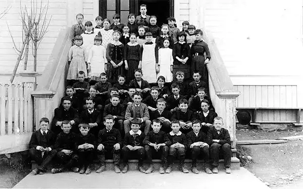
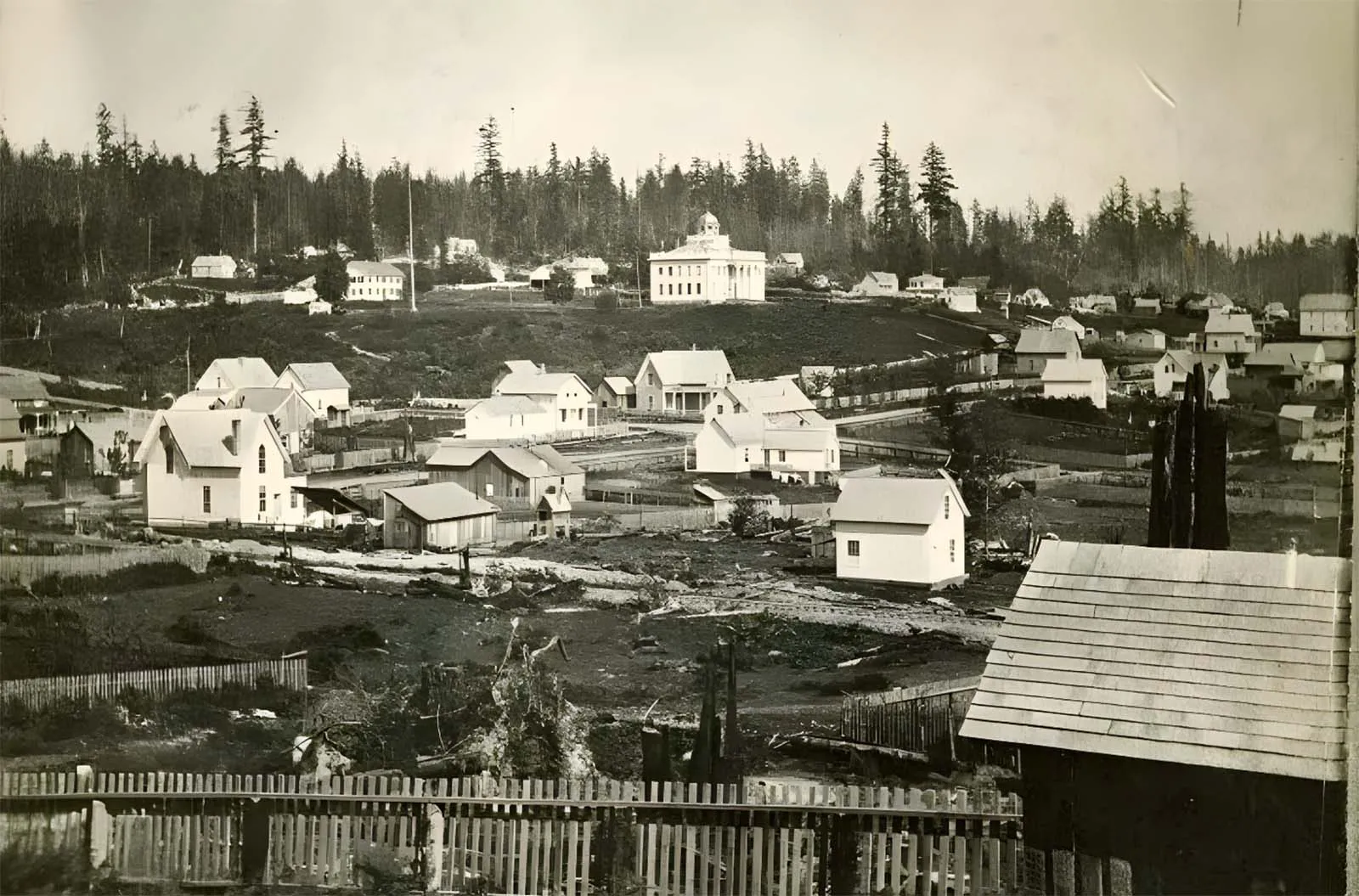
Central School, children, and teachers posed on steps, 1870.
The first bathtub with plumbing was in 1870. In the 1880s, Seattle got its first streetcar and cable car, ferry service, a YMCA gymnasium, and the exclusive Rainier Club, and passed an ordinance requiring attached sewer lines for all new residences. It also began to develop a road system.
The early Seattle era came to a stunning halt with the Great Seattle Fire of June 6, 1889. Started by a glue pot, the fire burned 29 city blocks (almost entirely wooden buildings; about 10 brick buildings also burned).
It destroyed nearly the entire business district, all of the railroad terminals, and all but four of the wharves.
Major fires like this were common in Washington that summer: the center of Ellensburg was destroyed by fire on July 4 and downtown Spokane burned on August 4.
Thanks in part to credit arranged by Jacob Furth, Seattle rebuilt from the ashes with astounding rapidity. A new zoning code resulted in a downtown of brick and stone buildings, rather than wood.
In the single year after the fire, the city grew from 25,000 to 40,000 inhabitants, largely because of the enormous number of construction jobs suddenly created.

Arlington House horse-drawn coach, 1879.
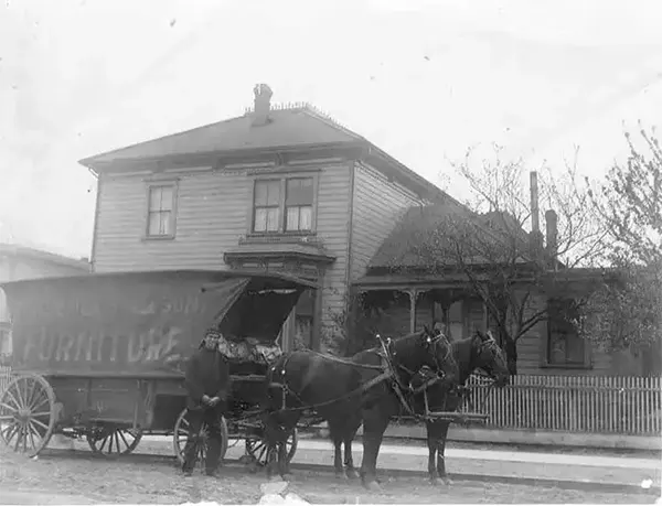
David Judkins’ house with John Roby Judkins standing in front of Frederick & Nelson furniture wagon, Seattle, 1879.
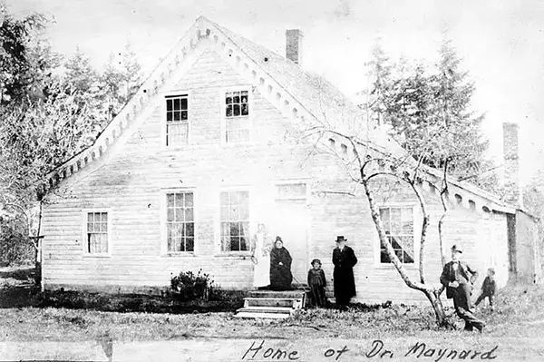
Dr. David Swinson Maynard residence near Alki, 1873.
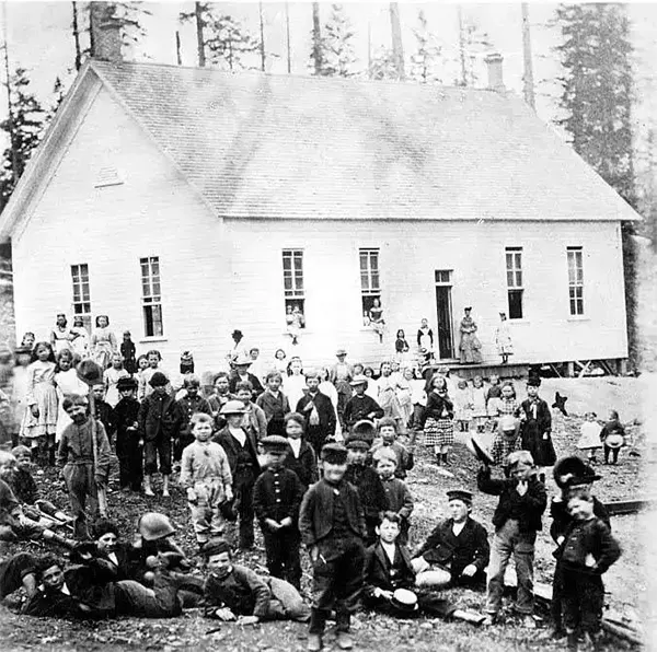
North School, building and school children, 1879.

Old schoolhouse, 1879. Old Sixth Street School, moved to south side, Marion St and east of Seventh Ave.

Washington Territorial University, 1879.

Yesler Way from 1st Ave., 1875.
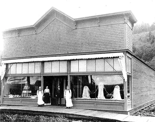
Store in Queen Anne, 1871.
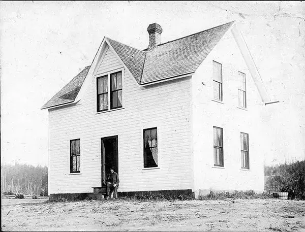
Unidentified residence at Queen Aveneue in Seattle, 1870.
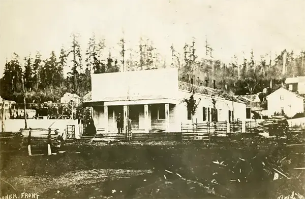
1st Ave. S. north from S. Washington Street, 1870.
The picture above: Looking North, just below Washington St. intersection. Right center: Occidental hotel (with flagstaff). Above that: Dr. H.A. Smith house. Above that: C.C. Terry house (white fence and gables).
Below right of Terry house: J. Collins house. Left of hotel: Hillory Butler house (small white). Center: first Masonic Hall (Dark Bldg.) Above that: Methodist Episcopal Church (white church).”

Yesler House, 1870.
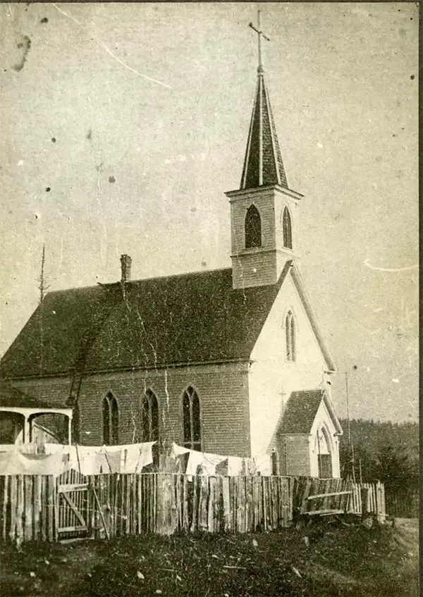
Our Lady of Good Help Church, 1870.
The picture above: Fourth Avenue. South and Park Avenue (Washington Street). Built 1866-1870. Enlarged 1883. 1870. First Catholic church in Seattle. Porch of Baxter house at left.
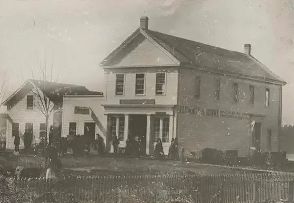
Plummer’s store, 1870.
The picture above: Later Plummer & Hinds with post office in the store. Commercial and Main. Built 1859; destroyed by fire June 6, 1889.

Territorial University, 1870,
The picture above: Territorial University. Main building exterior. Fourth Avenue and University Street. Built 1861-1862. Demolished 1910 (the columns are now in the Sylvan Theater, University campus) 1864.

View from 2nd Ave. and Pike Street, 1870.
The picture above: From Second Avenue and Pike Street. 1870. 1. A. A. Denny house. 2. Yesler’s mill and wharf. 3. Front Street. 4. Union Street.

1st Ave. looking north from Cherry Street, 1876.
The picture above: View looking north on Commercial Street from Cherry Street showing Yesler’s Hall, the Masonic Hall, the Cosmopolitan Hotel (later the Esmond Hotel), and Pioneer Drug Store. The Central School can be seen in the distance on the left side.

1st Ave. north from Main Street, 1879.

1st Avenue. S. between S. Washington St. and S. Main Street, 1870.
The picture above: East side between Washington Street and Main Street. On verso: Pinkham’s Variety store, Levy’s Pawn shop, Eureka Bakery. Wyckoff home (with veranda) S. E. corner of Second Avenue and Cherry Street.
Dick Atkins home (above that). Pinkham’s Variety Store, Levy’s Pawn Shop, Eureka Bakery. Wyckoff home (with verandah), S. E. corner of Second and Cherry. Dick Atkins home (above). J. M. Colman’s home above that.

1st Avenue S. north from S. Washington Street, 1870.

1st Ave. south from Cherry Street, 1874.
The picture above: Looking South from Cherry Street. 1. Sanders Block. 2. Vanity Fair beer hall. 3. Western Union Telegraph Office.
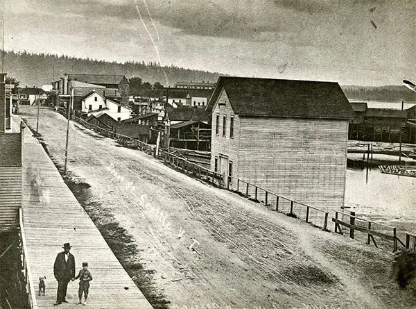
1st Avenue, south from Madison Street, 1879.
The picture above: Looking South from Madison Street. A.W. Piper and son, Walter, in foreground. 1. Occidental Brotherhood Building. 2. Schmeig’s Brewery.
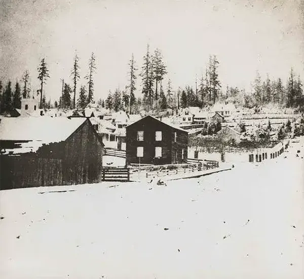
Boren House at 2nd. Ave. and Cherry Street, 1870.
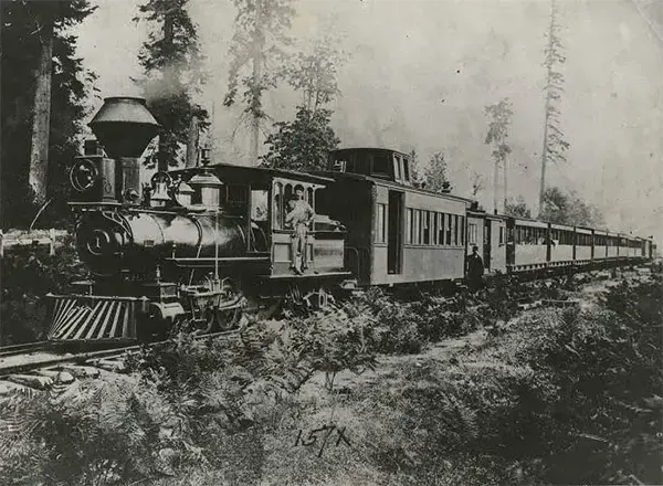
First trip of Seattle and Walla Walla Railroad, March 7, 1877.
The picture above: Seattle and Walla Walla Railroad. First passenger train. 1877. Initial trip between Seattle and Renton, March 7, 1877.

First trip of Seattle Coal Company railroad, December 1871.
The picture above: First train coming in from Lake Union on Seattle’s first railroad. December 25, 1871. South end of Lake Union. Tracks followed what is now Westlake Avenue.
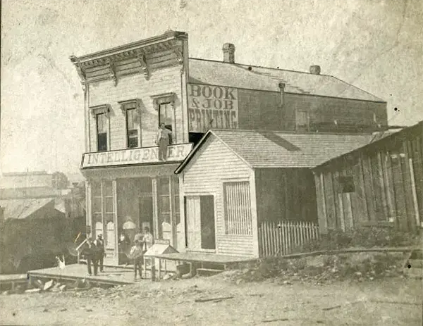
Intelligencer Office near 1st Ave. and Cherry Street, 1876.
The picture above: Constructed by Henry Yesler in 1874, this building served as an office for the Seattle Intelligencer Newspaper (which would later evolve into the Seattle Post-Intelligencer.)
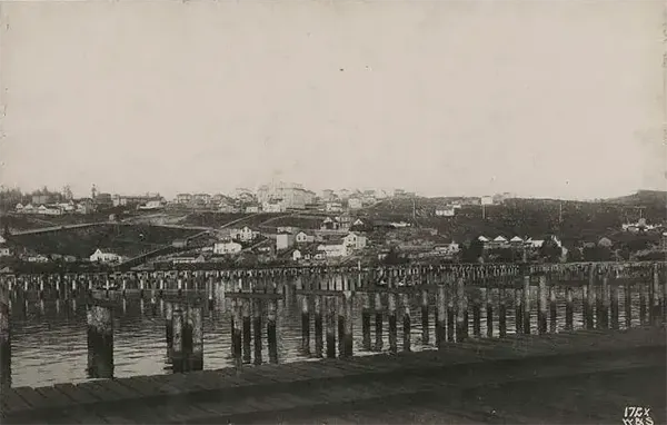
King Street wharves, 1878.
The picture above: Wharves at the foot of King St. and Weller St. Academy of the Holy Names at center background.

Occidental Hotel at 1st Ave. and James Street, 1872.
The picture above: Front Street [1st Ave.] and James Street. Built 1865; demolished about 1883. As seen from Occidental Ave. and Main St. 1872. 1. Mrs. Francis Guy’s boarding house 2. Occidental hotel 3. A. Slorah’s saloon.

Phillips, Horton and Co. Bank, 1876.
The picture above: Phillips, Horton and co. bank. Commercial St. and Washington St. Built 1875; gutted by fire June 6, 1889. 1876. Crawford and Harrington, Ship chandlers, at right.
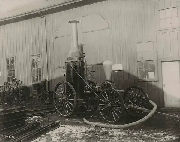
Seattle’s first fire engine, 1879.

Steamer “Alida,” 1870.
The picture above: Alida (Steamer). At wharf at foot of Columbia Street. 1870. Built in Seattle in 1860s. On Seattle to Victoria run, burned at Gig Harbor in 1890s. First Methodist Protestant Church (the ‘Brown Church’) at left.
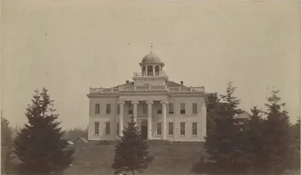
Territorial University, 1870.
The picture above: The main Territorial University Building was constructed in 1861.

View from 1st Ave. and Pike St. looking south 1878.
The picture above: From 1st Ave. and Pike St., 1878. Looking south. Photo by Peiser, Theodore E.. Center background. Arlington Hotel; Yesler’s mill & Yesler’s dock.
Wreck of bark “Windward” in front of dock; M.R. Moddock’s bldg., left in front of trestle; R.H. Denny Home, n. side of Union St.; A.A. Denny Home, s. side of Union St.; Young naturalists first home, rear of A.A. Denny home.

View from 2nd Ave. and Pike Street, 1870.
The picture above: From Second Avenue and Pike Street. 1870 Looking southeast. 1. Territorial University. 2. Andrew W. Piper house.

View from 3rd Ave. and Seneca Street, 1875.
The picture above: From Third Avenue and Seneca Street. 1875. Looking southeast from roof of Territorial University. 1. Yesler’s mill and wharf. 2. Harrington and Smith’s dock. 3. ‘Brown’ church. 4. Thorndyke house. 5. Robert Moran house. 6. Irving Ballard house. 7. Sandow house. 8. Steamer Zephyr.
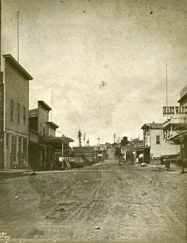
View north from 1st Ave. and Cherry, 1870.
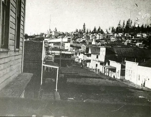
View north from 1st Ave. S. and S. Main Street, 1876.

View NW on 1st Ave. S. from S. Main Street, 1870.
The picture above: Commercial Street [1st Ave. S.]. 1876. Looking North from Main Street. 1. Yesler’s Hall. 2. Masonic Hall. 3. Cosmopolitan Hotel (later Esmond Hotel).

Yesler Way, west from 1st Avenue, 1875.
The picture above: Looking West from Front Street. 1. Yesler’s mill. 2. News and Book depot. 3. City market. 4. Matthew A. Kelly’s Pioneer Drug Store. 5. Seattle Bakery.

First logs on Columbia and Puget Sound Railroad, 1879.

First logs on Columbia and Puget Sound Railroad, 1879.
